
Thursday Walk: Clwydian Range
(log in to member's area for restricted information such as mobile numbers)
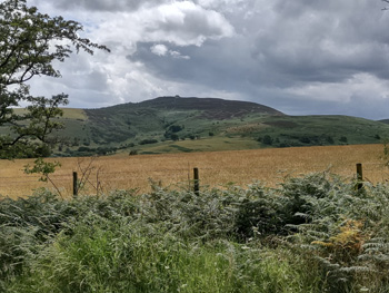
A circular walk along the Footpaths & Lanes around Moel Y Parc, Penycloddiau & Moel Arthur.
Meet 9:30 for 9:45 start at the car parking area West of Cilcain, Grid Ref: 169 652. OS Explorer Map #265 Clwydian Range.
Directions from Cilcain. From the crossroads in the centre of Cilcain, go West uphill through the village, past the White Horse Pub (RHS) to the Church. At the junction with the Church, take the Right fork and continue uphill for 100+ yards and take the next turn Left. (Spot Height on the map 247, in black ink.) The Car parking layby is on your RHS after 200 yards. (Summit height 263 in brown ink.)
The walk will take in the foot paths, lanes & woods in a Northernly direction to Moel Y Parc, before returning back to Cilcain via the Offa's Dyke Path, Penycloddiau Hill Fort (440) & Moel Arthur (456). Distance 9/10 miles. (Approx.)
Can you let Dave know in advance via email, if you're coming & with a current mobile number.